 vesseltracker.com
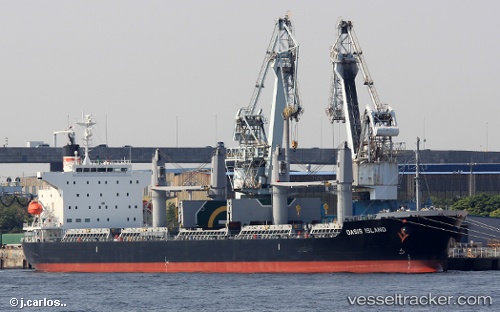
Vessel Oasis Island IMO: 9758753, MMSI: 374213000 Bulk Carrier
UTC, 22.04167, -109.90167, course: -1, speed: 11
UTC, 22.13767, -110.04385, course: 302, speed: 11.6
2026-02-10 06:16:01 UTC, 22.34166, -110.35333, course: -1, speed: 11
Live AIS position:
UTC. 40 nm SW of Los Cabos),
updated 2026-02-10 06:16:01 UTC.
Find the position of the vessel Oasis Island on the map. The latter are known coordinates and path.
marine traffic ship tracker show on live map
The current position of vessel Oasis Island is 22.34166 lat / -110.35333 lng. Updated: 2026-02-10 06:16:01 UTCCurrently sailing under the flag of Panama
Details:
Last coordinates of the vessel:
UTC, 21.82366, -109.55989, course: 304, speed: 12.3UTC, 22.04167, -109.90167, course: -1, speed: 11
UTC, 22.13767, -110.04385, course: 302, speed: 11.6
2026-02-10 06:16:01 UTC, 22.34166, -110.35333, course: -1, speed: 11