 vesseltracker.com
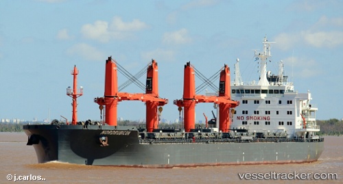
Vessel TOMINI BORA IMO: 9763693, MMSI: 538009922 Bulk Carrier
Live AIS position:
UTC. Near Zandvliet),
updated 2025-11-03 15:05:32 UTC.
Find the position of the vessel TOMINI BORA on the map. The latter are known coordinates and path.
marine traffic ship tracker show on live map
The current position of vessel TOMINI BORA is 51.35279 lat / 4.24729 lng. Updated: 2025-11-03 15:05:32 UTCCurrently sailing under the flag of Marshall Islands
TOMINI BORA built in 2016 year
Deadweight:
37985 tDetails:
Last coordinates of the vessel:
2025-11-03 15:05:32 UTC, 51.35279, 4.24729, course: 115, speed: 8.1