 vesseltracker.com
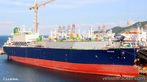
Vessel Patris IMO: 9766889, MMSI: 636018010 Lng Tanker
UTC, 1.37675, 103.22504, course: 316, speed: 16.4
UTC, 1.54600, 103.00732, course: 306, speed: 17.2
2026-02-20 01:26:44 UTC, 2.08761, 102.12550, course: 312, speed: 14.5
Live AIS position:
UTC. Near Malacca),
updated 2026-02-20 01:26:44 UTC.
Find the position of the vessel Patris on the map. The latter are known coordinates and path.
marine traffic ship tracker show on live map
The current position of vessel Patris is 2.08761 lat / 102.12550 lng. Updated: 2026-02-20 01:26:44 UTCCurrently sailing under the flag of Liberia
Details:
Last coordinates of the vessel:
UTC, 1.16355, 103.68660, course: 300, speed: 9.2UTC, 1.37675, 103.22504, course: 316, speed: 16.4
UTC, 1.54600, 103.00732, course: 306, speed: 17.2
2026-02-20 01:26:44 UTC, 2.08761, 102.12550, course: 312, speed: 14.5