 vesseltracker.com
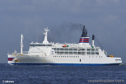
Vessel Ogasawara Maru IMO: 9767687, MMSI: 431347000 Passenger General Cargo Ship
UTC, 32.43830, 140.50111, course: 171, speed: 24.3
UTC, 31.92455, 140.64220, course: 170, speed: 24.1
2026-02-13 14:11:49 UTC, 30.91449, 140.97302, course: 164, speed: 23.6
Live AIS position:
UTC. 233 nm S of Toshima/Tokyo),
updated 2026-02-13 14:11:49 UTC.
Find the position of the vessel Ogasawara Maru on the map. The latter are known coordinates and path.
marine traffic ship tracker show on live map
The current position of vessel Ogasawara Maru is 30.91449 lat / 140.97302 lng. Updated: 2026-02-13 14:11:49 UTCCurrently sailing under the flag of Japan
Details:
Last coordinates of the vessel:
UTC, 33.61288, 140.12070, course: 171, speed: 24.7UTC, 32.43830, 140.50111, course: 171, speed: 24.3
UTC, 31.92455, 140.64220, course: 170, speed: 24.1
2026-02-13 14:11:49 UTC, 30.91449, 140.97302, course: 164, speed: 23.6