 vesseltracker.com
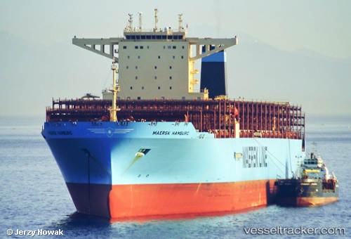
Vessel Maersk Hamburg IMO: 9784312, MMSI: 563053300 Container Ship
UTC, -26.25833, 47.40167, course: -1, speed: 18
UTC, -25.97718, 47.95557, course: 57, speed: 18.6
2026-03-24 21:59:32 UTC, -25.68273, 48.52852, course: 60, speed: 18.9
Live Vessel Maersk Hamburg Analytics (details, animations, etc.)
Live AIS position: UTC. 91 nm SE of Fort Dauphin), updated 2026-03-24 21:59:32 UTC.Find the position of the vessel Maersk Hamburg on the map. The latter are known coordinates and path.
marine traffic ship tracker show on live map
The current position of vessel Maersk Hamburg is -25.68273 lat / 48.52852 lng. Updated: 2026-03-24 21:59:32 UTCDetails:
Last coordinates of the vessel:
UTC, -26.64245, 46.62267, course: 62, speed: 18.8UTC, -26.25833, 47.40167, course: -1, speed: 18
UTC, -25.97718, 47.95557, course: 57, speed: 18.6
2026-03-24 21:59:32 UTC, -25.68273, 48.52852, course: 60, speed: 18.9