 vesseltracker.com
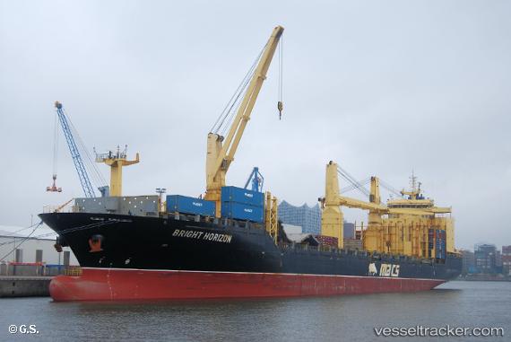
Vessel BRIGHT HORIZON IMO: 9787780, MMSI: 373077000 Crude Oil Tanker
UTC, 35.48527, 139.78484, course: 40, speed: 0
UTC, 35.48528, 139.78482, course: 40, speed: 0
2026-02-19 01:36:40 UTC, 35.48527, 139.78487, course: 40, speed: 0
Live AIS position:
UTC. Near Kawasaki),
updated 2026-02-19 01:36:40 UTC.
Find the position of the vessel BRIGHT HORIZON on the map. The latter are known coordinates and path.
marine traffic ship tracker show on live map
The current position of vessel BRIGHT HORIZON is 35.48527 lat / 139.78487 lng. Updated: 2026-02-19 01:36:40 UTCCurrently sailing under the flag of Panama
BRIGHT HORIZON built in 2018 year
Deadweight:
312395 tDetails:
Last coordinates of the vessel:
UTC, 35.48529, 139.78487, course: 40, speed: 0UTC, 35.48527, 139.78484, course: 40, speed: 0
UTC, 35.48528, 139.78482, course: 40, speed: 0
2026-02-19 01:36:40 UTC, 35.48527, 139.78487, course: 40, speed: 0