 vesseltracker.com
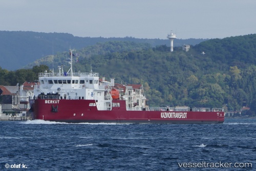
Vessel Berkut IMO: 9814533, MMSI: 436000366 Deck Cargo Ship
UTC, 41.35833, 50.85167, course: -1, speed: 6
UTC, 42.11333, 50.94333, course: -1, speed: 6
2026-03-24 07:57:53 UTC, 42.11333, 50.94333, course: -1, speed: 6
Live Vessel Berkut Analytics (details, animations, etc.)
Live AIS position: UTC. 72 nm SW of Kuryk), updated 2026-03-24 07:57:53 UTC.Find the position of the vessel Berkut on the map. The latter are known coordinates and path.
marine traffic ship tracker show on live map
The current position of vessel Berkut is 42.11333 lat / 50.94333 lng. Updated: 2026-03-24 07:57:53 UTCDetails:
Last coordinates of the vessel:
UTC, 41.35833, 50.85167, course: -1, speed: 6UTC, 41.35833, 50.85167, course: -1, speed: 6
UTC, 42.11333, 50.94333, course: -1, speed: 6
2026-03-24 07:57:53 UTC, 42.11333, 50.94333, course: -1, speed: 6