 vesseltracker.com
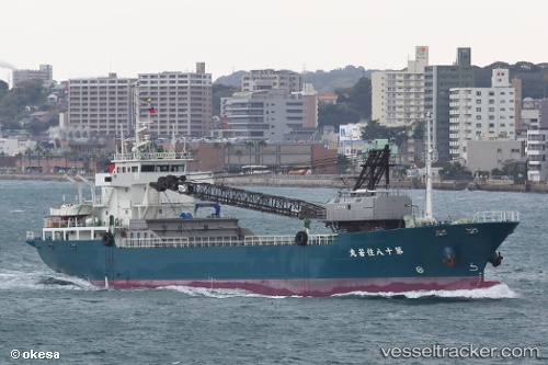
Vessel No.18 Sumiwakamaru IMO: 9822401, MMSI: 431009557 General Cargo Ship
UTC, 39.58702, 142.10744, course: 173, speed: 11.2
UTC, 39.07021, 141.93895, course: 198, speed: 11.5
2026-03-20 11:56:48 UTC, 38.57921, 141.74500, course: 196, speed: 12
Live Vessel No.18 Sumiwakamaru Analytics (details, animations, etc.)
Live AIS position: UTC. 16 nm NE of ONAGAWA), updated 2026-03-20 11:56:48 UTC.Find the position of the vessel No.18 Sumiwakamaru on the map. The latter are known coordinates and path.
marine traffic ship tracker show on live map
The current position of vessel No.18 Sumiwakamaru is 38.57921 lat / 141.74500 lng. Updated: 2026-03-20 11:56:48 UTCDetails:
Last coordinates of the vessel:
UTC, 39.96121, 142.01138, course: 165, speed: 11.3UTC, 39.58702, 142.10744, course: 173, speed: 11.2
UTC, 39.07021, 141.93895, course: 198, speed: 11.5
2026-03-20 11:56:48 UTC, 38.57921, 141.74500, course: 196, speed: 12