 vesseltracker.com
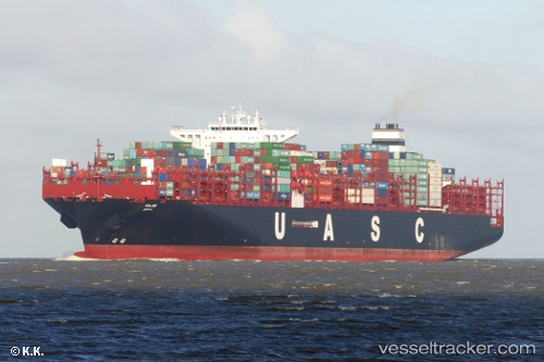
Vessel Sajir IMO: 9708784, MMSI: 211108000 Container Ship
UTC, -32.88993, 31.80562, course: 250, speed: 19
UTC, -33.05865, 31.21725, course: 249, speed: 19.3
2026-03-05 03:22:39 UTC, -33.05865, 31.21725, course: 249, speed: 19.3
Live Vessel Sajir Analytics (details, animations, etc.)
Live AIS position: UTC. 121 nm SE of Port Saint John's), updated 2026-03-05 03:22:39 UTC.Find the position of the vessel Sajir on the map. The latter are known coordinates and path.
marine traffic ship tracker show on live map
The current position of vessel Sajir is -33.05865 lat / 31.21725 lng. Updated: 2026-03-05 03:22:39 UTCCurrently sailing under the flag of Germany
Details:
Last coordinates of the vessel:
UTC, -32.88993, 31.80562, course: 250, speed: 19UTC, -32.88993, 31.80562, course: 250, speed: 19
UTC, -33.05865, 31.21725, course: 249, speed: 19.3
2026-03-05 03:22:39 UTC, -33.05865, 31.21725, course: 249, speed: 19.3