 vesseltracker.com
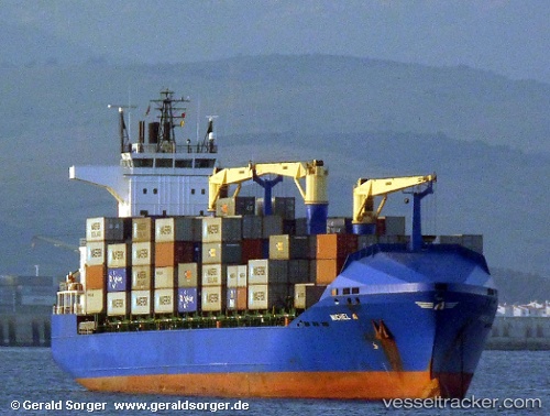
Vessel MICHEL A IMO: 9379349, MMSI: 215417000 Container Ship
UTC, 38.805, 0.478333, course: -1, speed: 13
UTC, 38.4617, 0.188333, course: -1, speed: 13
2026-03-05 09:21:12 UTC, 38.2883, 0.0416667, course: -1, speed: 12
Live Vessel MICHEL A Analytics (details, animations, etc.)
Live AIS position: UTC. 18 nm SE of Villajoyosa), updated 2026-03-05 09:21:12 UTC.Find the position of the vessel MICHEL A on the map. The latter are known coordinates and path.
marine traffic ship tracker show on live map
The current position of vessel MICHEL A is 38.2883 lat / 0.0416667 lng. Updated: 2026-03-05 09:21:12 UTCCurrently sailing under the flag of Malta
MICHEL A built in 2007 year
Deadweight:
22014 tDetails:
Last coordinates of the vessel:
UTC, 39.1567, 1.02667, course: -1, speed: 12UTC, 38.805, 0.478333, course: -1, speed: 13
UTC, 38.4617, 0.188333, course: -1, speed: 13
2026-03-05 09:21:12 UTC, 38.2883, 0.0416667, course: -1, speed: 12