 vesseltracker.com
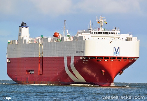
Vessel SEBRING EXPRESS IMO: 9434321, MMSI: 215876000 Vehicles Carrier
UTC, -17.1262, 77.4325, course: 53, speed: 15.2
UTC, -15.7376, 79.1188, course: 56, speed: 15.8
2026-03-05 02:29:35 UTC, -15.3958, 79.5594, course: 55, speed: 15.6
Live Vessel SEBRING EXPRESS Analytics (details, animations, etc.)
Live AIS position: UTC. Open sea (no nearby ports in database)), updated 2026-03-05 02:29:35 UTC.Find the position of the vessel SEBRING EXPRESS on the map. The latter are known coordinates and path.
marine traffic ship tracker show on live map
The current position of vessel SEBRING EXPRESS is -15.3958 lat / 79.5594 lng. Updated: 2026-03-05 02:29:35 UTCCurrently sailing under the flag of Malta
SEBRING EXPRESS built in 2009 year
Deadweight:
15154 tDetails:
Last coordinates of the vessel:
UTC, -17.1262, 77.4325, course: 53, speed: 15.2UTC, -17.1262, 77.4325, course: 53, speed: 15.2
UTC, -15.7376, 79.1188, course: 56, speed: 15.8
2026-03-05 02:29:35 UTC, -15.3958, 79.5594, course: 55, speed: 15.6