 vesseltracker.com
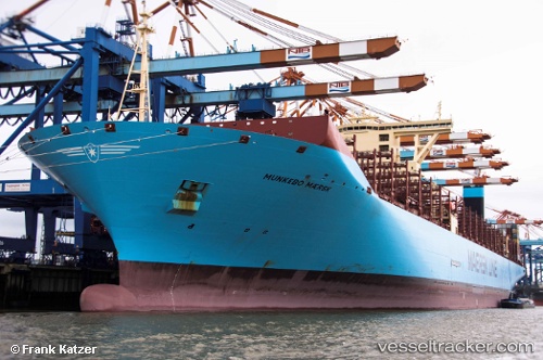
Vessel Munkebo Maersk IMO: 9632117, MMSI: 219021000 Container Ship
UTC, 19.45455, 119.02077, course: -1, speed: 16.8
UTC, 19.62197, 119.17337, course: -1, speed: 17.1
2026-03-04 18:22:42 UTC, 19.62197, 119.17337, course: -1, speed: 17.1
Live Vessel Munkebo Maersk Analytics (details, animations, etc.)
Live AIS position: UTC. 111 nm NW of Bangui), updated 2026-03-04 18:22:42 UTC.Find the position of the vessel Munkebo Maersk on the map. The latter are known coordinates and path.
marine traffic ship tracker show on live map
The current position of vessel Munkebo Maersk is 19.62197 lat / 119.17337 lng. Updated: 2026-03-04 18:22:42 UTCCurrently sailing under the flag of Denmark
Details:
Last coordinates of the vessel:
UTC, 18.97500, 118.60333, course: -1, speed: 17UTC, 19.45455, 119.02077, course: -1, speed: 16.8
UTC, 19.62197, 119.17337, course: -1, speed: 17.1
2026-03-04 18:22:42 UTC, 19.62197, 119.17337, course: -1, speed: 17.1