 vesseltracker.com
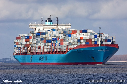
Vessel Georg Maersk IMO: 9320257, MMSI: 220416000 Container Ship
UTC, 49.98163, -145.54807, course: 299, speed: 19
UTC, 50.33333, -146.47833, course: -1, speed: 19
2026-03-05 12:10:56 UTC, 50.59667, -147.23833, course: -1, speed: 19
Live Vessel Georg Maersk Analytics (details, animations, etc.)
Live AIS position: UTC. 114 nm SE of Drinagh), updated 2026-03-05 12:10:56 UTC.Find the position of the vessel Georg Maersk on the map. The latter are known coordinates and path.
marine traffic ship tracker show on live map
The current position of vessel Georg Maersk is 50.59667 lat / -147.23833 lng. Updated: 2026-03-05 12:10:56 UTCDetails:
Last coordinates of the vessel:
UTC, 49.57833, -144.49167, course: -1, speed: 19UTC, 49.98163, -145.54807, course: 299, speed: 19
UTC, 50.33333, -146.47833, course: -1, speed: 19
2026-03-05 12:10:56 UTC, 50.59667, -147.23833, course: -1, speed: 19