 vesseltracker.com
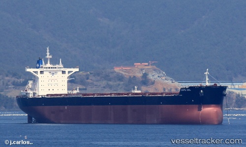
Vessel Cape Owl IMO: 9729219, MMSI: 235115994 Bulk Carrier
UTC, 32.78044, 123.74108, course: 347, speed: 12.4
UTC, 33.07493, 123.72038, course: 352, speed: 11.7
2026-03-04 19:14:25 UTC, 33.07493, 123.72038, course: 352, speed: 11.7
Live Vessel Cape Owl Analytics (details, animations, etc.)
Live AIS position: UTC. 91 nm SW of Gageohyangri), updated 2026-03-04 19:14:25 UTC.Find the position of the vessel Cape Owl on the map. The latter are known coordinates and path.
marine traffic ship tracker show on live map
The current position of vessel Cape Owl is 33.07493 lat / 123.72038 lng. Updated: 2026-03-04 19:14:25 UTCDetails:
Last coordinates of the vessel:
UTC, 32.40272, 123.75363, course: 348, speed: 13.2UTC, 32.78044, 123.74108, course: 347, speed: 12.4
UTC, 33.07493, 123.72038, course: 352, speed: 11.7
2026-03-04 19:14:25 UTC, 33.07493, 123.72038, course: 352, speed: 11.7