 vesseltracker.com
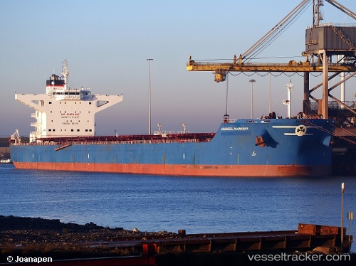
Vessel Maran Harmony IMO: 9434412, MMSI: 240979000 Bulk Carrier
UTC, -33.93333, 13.73833, course: -1, speed: 12
UTC, -33.93333, 13.73833, course: -1, speed: 12
2026-03-04 22:19:50 UTC, -33.65448, 12.55383, course: 274, speed: 7.9
Live Vessel Maran Harmony Analytics (details, animations, etc.)
Live AIS position: UTC. 269 nm W of Saldanha Bay), updated 2026-03-04 22:19:50 UTC.Find the position of the vessel Maran Harmony on the map. The latter are known coordinates and path.
marine traffic ship tracker show on live map
The current position of vessel Maran Harmony is -33.65448 lat / 12.55383 lng. Updated: 2026-03-04 22:19:50 UTCCurrently sailing under the flag of Greece
Maran Harmony built in 2010 year
Deadweight:
180391 tDetails:
Last coordinates of the vessel:
UTC, -33.93333, 13.73833, course: -1, speed: 12UTC, -33.93333, 13.73833, course: -1, speed: 12
UTC, -33.93333, 13.73833, course: -1, speed: 12
2026-03-04 22:19:50 UTC, -33.65448, 12.55383, course: 274, speed: 7.9