 vesseltracker.com
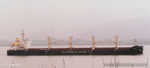
Vessel Rila IMO: 9754915, MMSI: 248056000 Bulk Carrier
UTC, 41.04318, -14.41213, course: 241, speed: 8.8
UTC, 40.87739, -14.82402, course: 244, speed: 9.2
2026-03-05 02:35:20 UTC, 40.70708, -15.23648, course: 246, speed: 8.6
Live Vessel Rila Analytics (details, animations, etc.)
Live AIS position: UTC. 179 nm W of Bear River City), updated 2026-03-05 02:35:20 UTC.Find the position of the vessel Rila on the map. The latter are known coordinates and path.
marine traffic ship tracker show on live map
The current position of vessel Rila is 40.70708 lat / -15.23648 lng. Updated: 2026-03-05 02:35:20 UTCCurrently sailing under the flag of Malta
Details:
Last coordinates of the vessel:
UTC, 41.37567, -13.59397, course: 241, speed: 9.5UTC, 41.04318, -14.41213, course: 241, speed: 8.8
UTC, 40.87739, -14.82402, course: 244, speed: 9.2
2026-03-05 02:35:20 UTC, 40.70708, -15.23648, course: 246, speed: 8.6