 vesseltracker.com
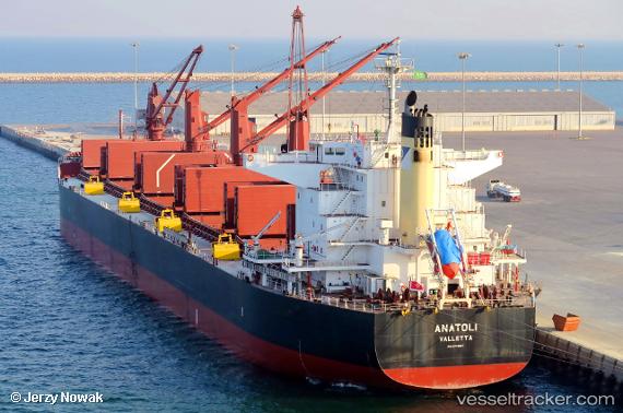
Vessel Anatoli IMO: 9791987, MMSI: 248546000 Bulk Carrier
UTC, -5.19130, 78.29176, course: 235, speed: 10.2
UTC, -5.49833, 77.81667, course: -1, speed: 10
2026-03-05 02:23:31 UTC, -5.68833, 77.52333, course: -1, speed: 10
Live Vessel Anatoli Analytics (details, animations, etc.)
Live AIS position: UTC. 317 nm E of Diego Garcia), updated 2026-03-05 02:23:31 UTC.Find the position of the vessel Anatoli on the map. The latter are known coordinates and path.
marine traffic ship tracker show on live map
The current position of vessel Anatoli is -5.68833 lat / 77.52333 lng. Updated: 2026-03-05 02:23:31 UTCDetails:
Last coordinates of the vessel:
UTC, -5.08741, 78.44800, course: 233, speed: 10.3UTC, -5.19130, 78.29176, course: 235, speed: 10.2
UTC, -5.49833, 77.81667, course: -1, speed: 10
2026-03-05 02:23:31 UTC, -5.68833, 77.52333, course: -1, speed: 10