 vesseltracker.com
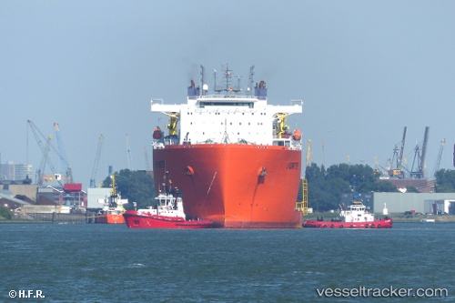
Vessel Forte IMO: 9592848, MMSI: 249364000 Heavy Load Carrier
UTC, -26.09174, 49.74173, course: 56, speed: 11.9
UTC, -25.98298, 49.95837, course: 55, speed: 11.6
2026-03-04 19:41:59 UTC, -25.67138, 50.43801, course: 47, speed: 10.8
Live Vessel Forte Analytics (details, animations, etc.)
Live AIS position: UTC. 190 nm E of Fort Dauphin), updated 2026-03-04 19:41:59 UTC.Find the position of the vessel Forte on the map. The latter are known coordinates and path.
marine traffic ship tracker show on live map
The current position of vessel Forte is -25.67138 lat / 50.43801 lng. Updated: 2026-03-04 19:41:59 UTCCurrently sailing under the flag of Malta
Forte built in 2012 year
Deadweight:
48164 tDetails:
Last coordinates of the vessel:
UTC, -26.21542, 49.48750, course: 55, speed: 12.5UTC, -26.09174, 49.74173, course: 56, speed: 11.9
UTC, -25.98298, 49.95837, course: 55, speed: 11.6
2026-03-04 19:41:59 UTC, -25.67138, 50.43801, course: 47, speed: 10.8