 vesseltracker.com
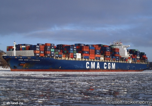
Vessel CMA CGM LA TRAVIATA IMO: 9299795, MMSI: 249661000 Container Ship
UTC, 23.63485, -112.16054, course: 129, speed: 18.3
UTC, 23.23206, -111.63124, course: 129, speed: 18.3
2026-03-05 07:46:33 UTC, 22.88501, -111.16186, course: 129, speed: 18.3
Live Vessel CMA CGM LA TRAVIATA Analytics (details, animations, etc.)
Live AIS position: UTC. 70 nm W of Los Cabos), updated 2026-03-05 07:46:33 UTC.Find the position of the vessel CMA CGM LA TRAVIATA on the map. The latter are known coordinates and path.
marine traffic ship tracker show on live map
The current position of vessel CMA CGM LA TRAVIATA is 22.88501 lat / -111.16186 lng. Updated: 2026-03-05 07:46:33 UTCCurrently sailing under the flag of Malta
Details:
Last coordinates of the vessel:
UTC, 23.97833, -112.62333, course: -1, speed: 18UTC, 23.63485, -112.16054, course: 129, speed: 18.3
UTC, 23.23206, -111.63124, course: 129, speed: 18.3
2026-03-05 07:46:33 UTC, 22.88501, -111.16186, course: 129, speed: 18.3