 vesseltracker.com
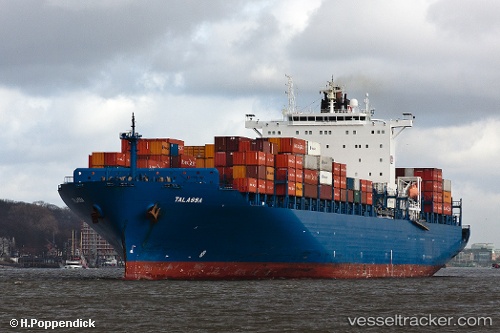
Vessel Talassa IMO: 9290787, MMSI: 255805780 Container Ship
UTC, 14.65415, -17.88795, course: 357, speed: 19.3
UTC, 15.42749, -17.91005, course: 0, speed: 19.5
2026-03-05 00:18:09 UTC, 16.13826, -17.90731, course: 1, speed: 19.7
Live Vessel Talassa Analytics (details, animations, etc.)
Live AIS position: UTC. 81 nm W of Saint Louis), updated 2026-03-05 00:18:09 UTC.Find the position of the vessel Talassa on the map. The latter are known coordinates and path.
marine traffic ship tracker show on live map
The current position of vessel Talassa is 16.13826 lat / -17.90731 lng. Updated: 2026-03-05 00:18:09 UTCCurrently sailing under the flag of Portugal
Talassa built in 2005 year
Deadweight:
68228 tDetails:
Last coordinates of the vessel:
UTC, 14.23859, -17.86692, course: 357, speed: 18.9UTC, 14.65415, -17.88795, course: 357, speed: 19.3
UTC, 15.42749, -17.91005, course: 0, speed: 19.5
2026-03-05 00:18:09 UTC, 16.13826, -17.90731, course: 1, speed: 19.7