 vesseltracker.com
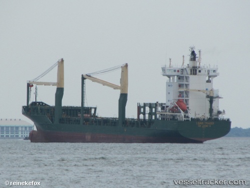
Vessel Msc Talia F IMO: 9308601, MMSI: 255805965 Container Ship
UTC, 40.35027, 18.82943, course: 204, speed: 11.5
UTC, 39.92568, 18.55509, course: 206, speed: 10.8
2026-03-05 06:33:30 UTC, 39.75351, 18.14283, course: 308, speed: 10.2
Live Vessel Msc Talia F Analytics (details, animations, etc.)
Live AIS position: UTC. Near Torre San Giovanni d'Ugento), updated 2026-03-05 06:33:30 UTC.Find the position of the vessel Msc Talia F on the map. The latter are known coordinates and path.
marine traffic ship tracker show on live map
The current position of vessel Msc Talia F is 39.75351 lat / 18.14283 lng. Updated: 2026-03-05 06:33:30 UTCCurrently sailing under the flag of Portugal
Msc Talia F built in 2005 year
Deadweight:
11815 tDetails:
Last coordinates of the vessel:
UTC, 40.56025, 18.99009, course: 209, speed: 10.5UTC, 40.35027, 18.82943, course: 204, speed: 11.5
UTC, 39.92568, 18.55509, course: 206, speed: 10.8
2026-03-05 06:33:30 UTC, 39.75351, 18.14283, course: 308, speed: 10.2