 vesseltracker.com
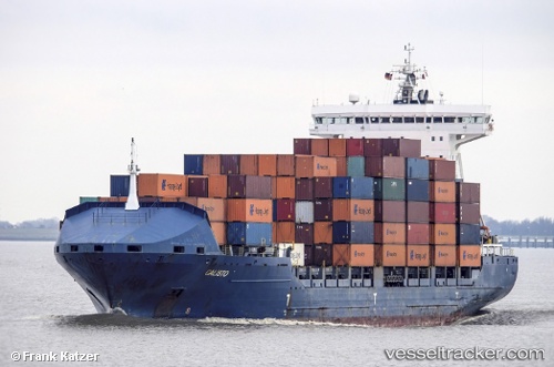
Vessel CALISTO IMO: 9306067, MMSI: 255806513 Container Ship
UTC, 51.32801, 4.27186, course: 185, speed: 10.6
UTC, 51.28383, 4.24933, course: 212, speed: 0
2026-03-05 00:08:51 UTC, 51.28383, 4.24933, course: 212, speed: 0
Live Vessel CALISTO Analytics (details, animations, etc.)
Live AIS position: UTC. Near Doel), updated 2026-03-05 00:08:51 UTC.Find the position of the vessel CALISTO on the map. The latter are known coordinates and path.
marine traffic ship tracker show on live map
The current position of vessel CALISTO is 51.28383 lat / 4.24933 lng. Updated: 2026-03-05 00:08:51 UTCCurrently sailing under the flag of Portugal (MAR)
CALISTO built in 2005 year
Deadweight:
20614 tDetails:
Last coordinates of the vessel:
UTC, 51.32801, 4.27186, course: 185, speed: 10.6UTC, 51.32801, 4.27186, course: 185, speed: 10.6
UTC, 51.28383, 4.24933, course: 212, speed: 0
2026-03-05 00:08:51 UTC, 51.28383, 4.24933, course: 212, speed: 0