 vesseltracker.com
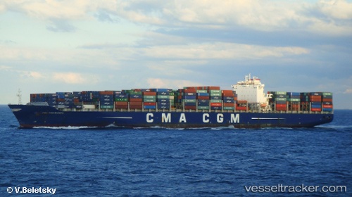
Vessel Cma Cgm Bianca IMO: 9436367, MMSI: 256604000 Container Ship
UTC, 1.25867, 103.78788, course: 30, speed: 0
UTC, 1.25873, 103.78788, course: 30, speed: 0
2026-03-05 07:38:48 UTC, 1.25863, 103.78780, course: 30, speed: 0
Live Vessel Cma Cgm Bianca Analytics (details, animations, etc.)
Live AIS position: UTC. Near Pasir Panjang Wharves), updated 2026-03-05 07:38:48 UTC.Find the position of the vessel Cma Cgm Bianca on the map. The latter are known coordinates and path.
marine traffic ship tracker show on live map
The current position of vessel Cma Cgm Bianca is 1.25863 lat / 103.78780 lng. Updated: 2026-03-05 07:38:48 UTCCurrently sailing under the flag of Malta
Cma Cgm Bianca built in 2011 year
Deadweight:
101433 tDetails:
Last coordinates of the vessel:
UTC, 1.24247, 103.78207, course: 344, speed: 3.6UTC, 1.25867, 103.78788, course: 30, speed: 0
UTC, 1.25873, 103.78788, course: 30, speed: 0
2026-03-05 07:38:48 UTC, 1.25863, 103.78780, course: 30, speed: 0