 vesseltracker.com
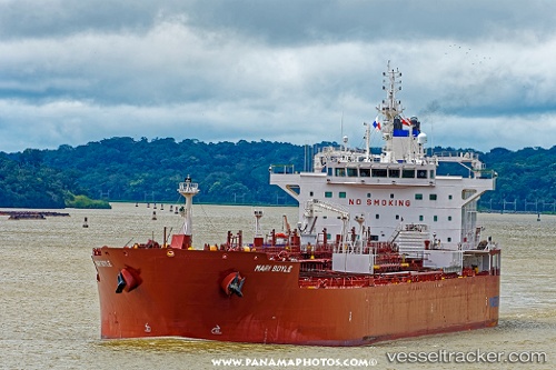
Vessel Mari Boyle IMO: 9732979, MMSI: 258741000 Oil Products Tanker
UTC, 22.23808, -113.36235, course: 118, speed: 12.5
UTC, 22.04500, -112.99667, course: -1, speed: 12
2026-03-05 10:30:44 UTC, 21.76529, -112.46978, course: 123, speed: 12.7
Live Vessel Mari Boyle Analytics (details, animations, etc.)
Live AIS position: UTC. 112 nm SE of Shitan), updated 2026-03-05 10:30:44 UTC.Find the position of the vessel Mari Boyle on the map. The latter are known coordinates and path.
marine traffic ship tracker show on live map
The current position of vessel Mari Boyle is 21.76529 lat / -112.46978 lng. Updated: 2026-03-05 10:30:44 UTCDetails:
Last coordinates of the vessel:
UTC, 22.46849, -113.78354, course: 118, speed: 12.3UTC, 22.23808, -113.36235, course: 118, speed: 12.5
UTC, 22.04500, -112.99667, course: -1, speed: 12
2026-03-05 10:30:44 UTC, 21.76529, -112.46978, course: 123, speed: 12.7