 vesseltracker.com
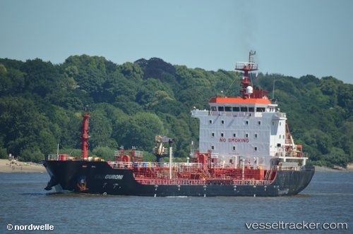
Vessel GURONI IMO: 9438248, MMSI: 271052146 Oil/Chemical Tanker
UTC, 38.78733, 26.91255, course: 268, speed: 0
UTC, 38.78733, 26.91255, course: 268, speed: 0
2026-02-24 06:14:43 UTC, 38.78733, 26.91257, course: 268, speed: 0
Live AIS position:
UTC. Near Nemrut Bay),
updated 2026-02-24 06:14:43 UTC.
Find the position of the vessel GURONI on the map. The latter are known coordinates and path.
marine traffic ship tracker show on live map
The current position of vessel GURONI is 38.78733 lat / 26.91257 lng. Updated: 2026-02-24 06:14:43 UTCCurrently sailing under the flag of Turkey
Details:
Last coordinates of the vessel:
UTC, 38.78731, 26.91249, course: 268, speed: 0UTC, 38.78733, 26.91255, course: 268, speed: 0
UTC, 38.78733, 26.91255, course: 268, speed: 0
2026-02-24 06:14:43 UTC, 38.78733, 26.91257, course: 268, speed: 0