 vesseltracker.com
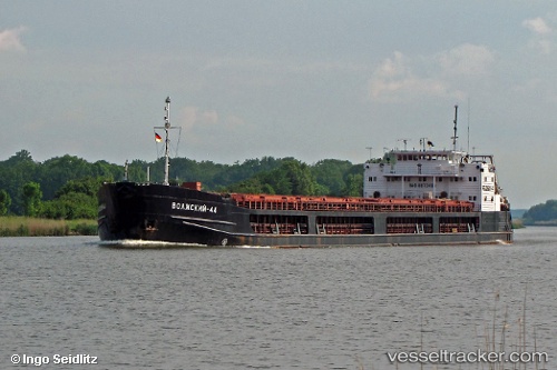
Vessel Volzhskiy 44 IMO: 8873489, MMSI: 273430620 General Cargo Ship
UTC, 41.41142, 41.43067, course: -1, speed: 0
UTC, 41.41140, 41.43068, course: -1, speed: 0.2
2026-03-04 22:07:13 UTC, 41.41137, 41.43063, course: -1, speed: 0
Live Vessel Volzhskiy 44 Analytics (details, animations, etc.)
Live AIS position: UTC. Near HOPA), updated 2026-03-04 22:07:13 UTC.Find the position of the vessel Volzhskiy 44 on the map. The latter are known coordinates and path.
marine traffic ship tracker show on live map
The current position of vessel Volzhskiy 44 is 41.41137 lat / 41.43063 lng. Updated: 2026-03-04 22:07:13 UTCCurrently sailing under the flag of Russia
Volzhskiy 44 built in 1991 year
Deadweight:
6050 tDetails:
Last coordinates of the vessel:
UTC, 41.41138, 41.43061, course: -1, speed: 0.2UTC, 41.41142, 41.43067, course: -1, speed: 0
UTC, 41.41140, 41.43068, course: -1, speed: 0.2
2026-03-04 22:07:13 UTC, 41.41137, 41.43063, course: -1, speed: 0