 vesseltracker.com
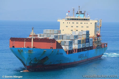
Vessel CICCIO IMO: 9192442, MMSI: 305007400 Container Ship
UTC, 34.85202, 123.52143, course: 245, speed: 12.1
UTC, 34.53839, 123.20742, course: 180, speed: 12.9
2026-03-02 11:09:47 UTC, 34.38856, 123.19844, course: 179, speed: 12.1
Live AIS position:
UTC. 96 nm W of Gageohyangri),
updated 2026-03-02 11:09:47 UTC.
Find the position of the vessel CICCIO on the map. The latter are known coordinates and path.
marine traffic ship tracker show on live map
The current position of vessel CICCIO is 34.38856 lat / 123.19844 lng. Updated: 2026-03-02 11:09:47 UTCCurrently sailing under the flag of Antigua and Barbuda
Details:
Last coordinates of the vessel:
UTC, 35.05756, 124.01360, course: -1, speed: 14.1UTC, 34.85202, 123.52143, course: 245, speed: 12.1
UTC, 34.53839, 123.20742, course: 180, speed: 12.9
2026-03-02 11:09:47 UTC, 34.38856, 123.19844, course: 179, speed: 12.1