 vesseltracker.com
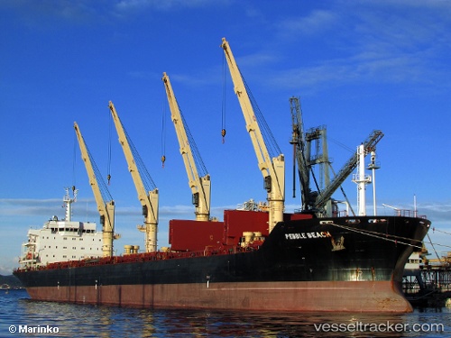
Vessel PEBBLE BEACH IMO: 9595979, MMSI: 305036300 Bulk Carrier
UTC, 22.17343, 114.16637, course: 109, speed: 0.1
UTC, 22.17296, 114.16623, course: 92, speed: 0.1
2026-02-24 17:44:33 UTC, 22.17311, 114.16624, course: 97, speed: 0.1
Live AIS position:
UTC. Near Tai Tam),
updated 2026-02-24 17:44:33 UTC.
Find the position of the vessel PEBBLE BEACH on the map. The latter are known coordinates and path.
marine traffic ship tracker show on live map
The current position of vessel PEBBLE BEACH is 22.17311 lat / 114.16624 lng. Updated: 2026-02-24 17:44:33 UTCCurrently sailing under the flag of Antigua and Barbuda
Details:
Last coordinates of the vessel:
UTC, 22.17381, 114.16670, course: 126, speed: 0.1UTC, 22.17343, 114.16637, course: 109, speed: 0.1
UTC, 22.17296, 114.16623, course: 92, speed: 0.1
2026-02-24 17:44:33 UTC, 22.17311, 114.16624, course: 97, speed: 0.1