 vesseltracker.com
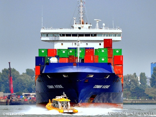
Vessel Conmarynue IMO: 9483358, MMSI: 305896000 Container Ship
UTC, 53.18918, 5.42756, course: -1, speed: 0
UTC, 53.18919, 5.42754, course: -1, speed: 0
2026-03-04 22:20:25 UTC, 53.18919, 5.42753, course: -1, speed: 0
Live Vessel Conmarynue Analytics (details, animations, etc.)
Live AIS position: UTC. Near HARLINGEN), updated 2026-03-04 22:20:25 UTC.Find the position of the vessel Conmarynue on the map. The latter are known coordinates and path.
marine traffic ship tracker show on live map
The current position of vessel Conmarynue is 53.18919 lat / 5.42753 lng. Updated: 2026-03-04 22:20:25 UTCCurrently sailing under the flag of Antigua Barbuda
Conmarynue built in 2012 year
Deadweight:
13000 tDetails:
Last coordinates of the vessel:
UTC, 53.18919, 5.42750, course: -1, speed: 0UTC, 53.18918, 5.42756, course: -1, speed: 0
UTC, 53.18919, 5.42754, course: -1, speed: 0
2026-03-04 22:20:25 UTC, 53.18919, 5.42753, course: -1, speed: 0