 vesseltracker.com
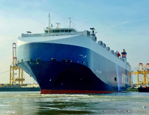
Vessel Opal Leader IMO: 9318498, MMSI: 309285000 Vehicles Carrier
UTC, -35.13916, -56.16365, course: 71, speed: 10.9
UTC, -35.07792, -55.91756, course: -1, speed: 15.9
2026-03-04 21:39:01 UTC, -35.06426, -54.87169, course: 93, speed: 16.9
Live Vessel Opal Leader Analytics (details, animations, etc.)
Live AIS position: UTC. Near PUNTA DEL ESTE), updated 2026-03-04 21:39:01 UTC.Find the position of the vessel Opal Leader on the map. The latter are known coordinates and path.
marine traffic ship tracker show on live map
The current position of vessel Opal Leader is -35.06426 lat / -54.87169 lng. Updated: 2026-03-04 21:39:01 UTCCurrently sailing under the flag of Bahamas
Opal Leader built in 2007 year
Deadweight:
12300 tDetails:
Last coordinates of the vessel:
UTC, -35.16831, -56.49576, course: 95, speed: 11.5UTC, -35.13916, -56.16365, course: 71, speed: 10.9
UTC, -35.07792, -55.91756, course: -1, speed: 15.9
2026-03-04 21:39:01 UTC, -35.06426, -54.87169, course: 93, speed: 16.9