 vesseltracker.com
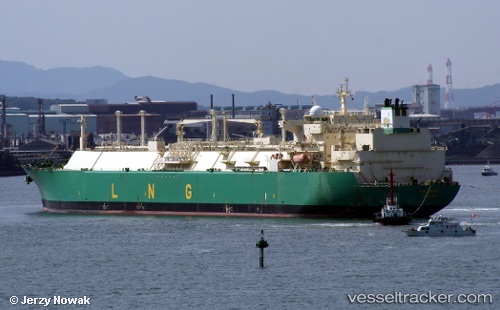
Vessel Lng Enugu IMO: 9266994, MMSI: 310482000 Lng Tanker
UTC, 25.03684, -16.24410, course: -1, speed: 16.3
UTC, 25.85436, -15.78504, course: 31, speed: 17.4
2026-03-05 00:13:41 UTC, 26.40167, -15.47333, course: -1, speed: 17
Live Vessel Lng Enugu Analytics (details, animations, etc.)
Live AIS position: UTC. 81 nm S of Maspalomas), updated 2026-03-05 00:13:41 UTC.Find the position of the vessel Lng Enugu on the map. The latter are known coordinates and path.
marine traffic ship tracker show on live map
The current position of vessel Lng Enugu is 26.40167 lat / -15.47333 lng. Updated: 2026-03-05 00:13:41 UTCCurrently sailing under the flag of Bermuda
Lng Enugu built in 2005 year
Deadweight:
83160 tDetails:
Last coordinates of the vessel:
UTC, 24.58433, -16.48314, course: 34, speed: 17UTC, 25.03684, -16.24410, course: -1, speed: 16.3
UTC, 25.85436, -15.78504, course: 31, speed: 17.4
2026-03-05 00:13:41 UTC, 26.40167, -15.47333, course: -1, speed: 17