 vesseltracker.com
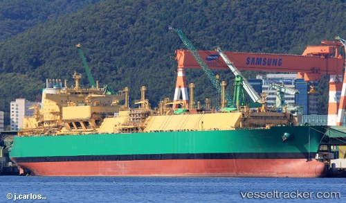
Vessel Lng Abuja Ii IMO: 9690169, MMSI: 310730000 Lng Tanker
UTC, 13.49553, 61.82263, course: 180, speed: 10.1
UTC, 11.93836, 61.73499, course: 187, speed: 10.1
2026-03-05 05:30:39 UTC, 11.93836, 61.73499, course: 187, speed: 10.1
Live Vessel Lng Abuja Ii Analytics (details, animations, etc.)
Live AIS position: UTC. Open sea, approx. 406 nm off the nearest listed port), updated 2026-03-05 05:30:39 UTC.Find the position of the vessel Lng Abuja Ii on the map. The latter are known coordinates and path.
marine traffic ship tracker show on live map
The current position of vessel Lng Abuja Ii is 11.93836 lat / 61.73499 lng. Updated: 2026-03-05 05:30:39 UTCDetails:
Last coordinates of the vessel:
UTC, 13.49553, 61.82263, course: 180, speed: 10.1UTC, 13.49553, 61.82263, course: 180, speed: 10.1
UTC, 11.93836, 61.73499, course: 187, speed: 10.1
2026-03-05 05:30:39 UTC, 11.93836, 61.73499, course: 187, speed: 10.1