 vesseltracker.com
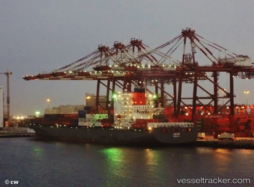
Vessel Limari IMO: 9290816, MMSI: 310761000 Container Ship
UTC, 46.54790, -72.15600, course: -1, speed: 14.6
UTC, 46.68241, -71.55616, course: 48, speed: 12
2026-03-04 22:03:08 UTC, 46.68241, -71.55616, course: 48, speed: 12
Live Vessel Limari Analytics (details, animations, etc.)
Live AIS position: UTC. Near Neuville), updated 2026-03-04 22:03:08 UTC.Find the position of the vessel Limari on the map. The latter are known coordinates and path.
marine traffic ship tracker show on live map
The current position of vessel Limari is 46.68241 lat / -71.55616 lng. Updated: 2026-03-04 22:03:08 UTCCurrently sailing under the flag of Bermuda
Limari built in 2005 year
Deadweight:
52683 tDetails:
Last coordinates of the vessel:
UTC, 46.54790, -72.15600, course: -1, speed: 14.6UTC, 46.54790, -72.15600, course: -1, speed: 14.6
UTC, 46.68241, -71.55616, course: 48, speed: 12
2026-03-04 22:03:08 UTC, 46.68241, -71.55616, course: 48, speed: 12