 vesseltracker.com
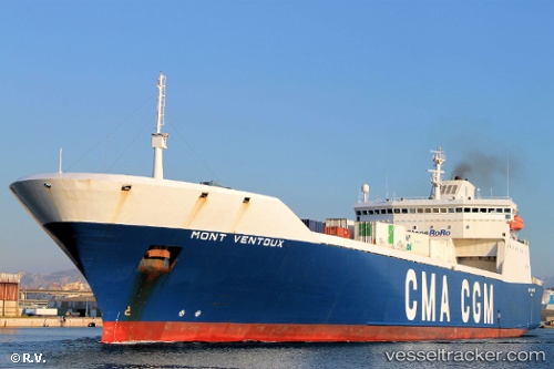
Vessel MONT VENTOUX IMO: 9129586, MMSI: 311001105 Ro-Ro Cargo Ship
UTC, 36.95775, 10.48841, course: 210, speed: 10.2
UTC, 36.78391, 10.43295, course: 142, speed: 3.5
2026-03-04 19:34:05 UTC, 36.78470, 10.43333, course: 163, speed: 0.6
Live Vessel MONT VENTOUX Analytics (details, animations, etc.)
Live AIS position: UTC. Near Borj Cedria), updated 2026-03-04 19:34:05 UTC.Find the position of the vessel MONT VENTOUX on the map. The latter are known coordinates and path.
marine traffic ship tracker show on live map
The current position of vessel MONT VENTOUX is 36.78470 lat / 10.43333 lng. Updated: 2026-03-04 19:34:05 UTCCurrently sailing under the flag of Bahamas
MONT VENTOUX built in 1996 year
Deadweight:
13364 tDetails:
Last coordinates of the vessel:
UTC, 37.18375, 10.86529, course: -1, speed: 9.3UTC, 36.95775, 10.48841, course: 210, speed: 10.2
UTC, 36.78391, 10.43295, course: 142, speed: 3.5
2026-03-04 19:34:05 UTC, 36.78470, 10.43333, course: 163, speed: 0.6