 vesseltracker.com
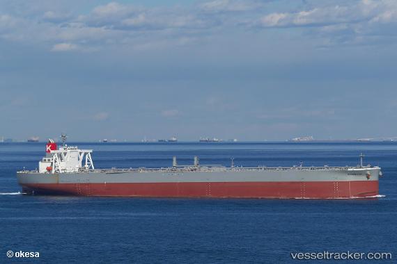
Vessel Tedorigawa IMO: 9805099, MMSI: 351915000 Crude Oil Tanker
UTC, 11.33500, 70.87833, course: -1, speed: 0
UTC, 11.34533, 70.90225, course: -1, speed: 0.7
2026-03-04 19:23:43 UTC, 11.34224, 70.91696, course: -1, speed: 0.4
Live Vessel Tedorigawa Analytics (details, animations, etc.)
Live AIS position: UTC. 108 nm W of Amini Island), updated 2026-03-04 19:23:43 UTC.Find the position of the vessel Tedorigawa on the map. The latter are known coordinates and path.
marine traffic ship tracker show on live map
The current position of vessel Tedorigawa is 11.34224 lat / 70.91696 lng. Updated: 2026-03-04 19:23:43 UTCCurrently sailing under the flag of Panama
Details:
Last coordinates of the vessel:
UTC, 11.32667, 70.86167, course: -1, speed: 0UTC, 11.33500, 70.87833, course: -1, speed: 0
UTC, 11.34533, 70.90225, course: -1, speed: 0.7
2026-03-04 19:23:43 UTC, 11.34224, 70.91696, course: -1, speed: 0.4