 vesseltracker.com
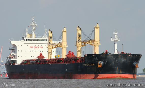
Vessel PAN IMPERIAL IMO: 9699361, MMSI: 352001187 Bulk Carrier
UTC, 46.92034, -124.11650, course: 253, speed: 0.1
UTC, 46.91997, -124.11522, course: 269, speed: 0.2
2026-03-04 19:33:45 UTC, 46.92038, -124.11517, course: 254, speed: 0
Live Vessel PAN IMPERIAL Analytics (details, animations, etc.)
Live AIS position: UTC. Near Ocean Shores), updated 2026-03-04 19:33:45 UTC.Find the position of the vessel PAN IMPERIAL on the map. The latter are known coordinates and path.
marine traffic ship tracker show on live map
The current position of vessel PAN IMPERIAL is 46.92038 lat / -124.11517 lng. Updated: 2026-03-04 19:33:45 UTCCurrently sailing under the flag of Panama
PAN IMPERIAL built in 2016 year
Deadweight:
63567 tDetails:
Last coordinates of the vessel:
UTC, 46.91884, -124.12308, course: 70, speed: 0.1UTC, 46.92034, -124.11650, course: 253, speed: 0.1
UTC, 46.91997, -124.11522, course: 269, speed: 0.2
2026-03-04 19:33:45 UTC, 46.92038, -124.11517, course: 254, speed: 0