 vesseltracker.com
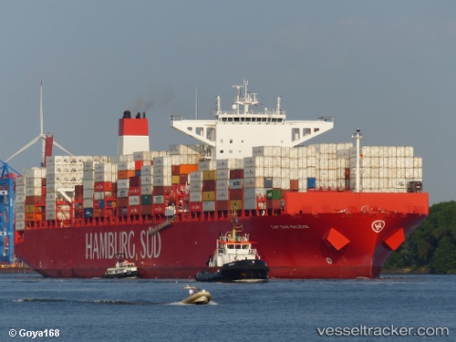
Vessel Cap San Maleas IMO: 9633941, MMSI: 353365000 Container Ship
UTC, -34.02354, 27.43101, course: 245, speed: 19.6
UTC, -34.26187, 26.75645, course: 251, speed: 19.9
2026-03-04 19:47:48 UTC, -34.52783, 26.08713, course: 249, speed: 19.9
Live Vessel Cap San Maleas Analytics (details, animations, etc.)
Live AIS position: UTC. 39 nm SE of Summerstrand), updated 2026-03-04 19:47:48 UTC.Find the position of the vessel Cap San Maleas on the map. The latter are known coordinates and path.
marine traffic ship tracker show on live map
The current position of vessel Cap San Maleas is -34.52783 lat / 26.08713 lng. Updated: 2026-03-04 19:47:48 UTCCurrently sailing under the flag of Panama
Cap San Maleas built in 2014 year
Deadweight:
120650 tDetails:
Last coordinates of the vessel:
UTC, -33.79601, 27.94625, course: 246, speed: 19UTC, -34.02354, 27.43101, course: 245, speed: 19.6
UTC, -34.26187, 26.75645, course: 251, speed: 19.9
2026-03-04 19:47:48 UTC, -34.52783, 26.08713, course: 249, speed: 19.9