 vesseltracker.com
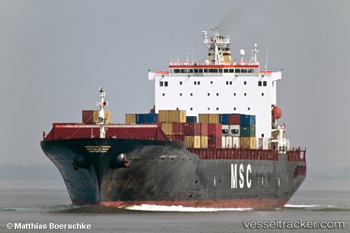
Vessel Msc Ingrid IMO: 9181651, MMSI: 354505000 Container Ship
UTC, 36.40333, -45.29167, course: -1, speed: 17
UTC, 36.38833, -44.28333, course: -1, speed: 17
2026-03-05 12:04:39 UTC, 36.38833, -43.71667, course: -1, speed: 16
Live Vessel Msc Ingrid Analytics (details, animations, etc.)
Live AIS position: UTC. 193 nm W of Eureka Springs), updated 2026-03-05 12:04:39 UTC.Find the position of the vessel Msc Ingrid on the map. The latter are known coordinates and path.
marine traffic ship tracker show on live map
The current position of vessel Msc Ingrid is 36.38833 lat / -43.71667 lng. Updated: 2026-03-05 12:04:39 UTCCurrently sailing under the flag of Panama
Msc Ingrid built in 1999 year
Deadweight:
67678 tDetails:
Last coordinates of the vessel:
UTC, 36.40932, -45.86342, course: 90, speed: 17.8UTC, 36.40333, -45.29167, course: -1, speed: 17
UTC, 36.38833, -44.28333, course: -1, speed: 17
2026-03-05 12:04:39 UTC, 36.38833, -43.71667, course: -1, speed: 16