 vesseltracker.com
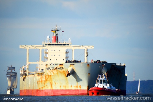
Vessel Cape Jacaranda IMO: 9446594, MMSI: 355471000 Bulk Carrier
UTC, 7.49545, 108.61852, course: 46, speed: 12
UTC, 7.80238, 108.91487, course: 43, speed: 12.6
2026-03-04 19:46:11 UTC, 8.13696, 109.19104, course: -1, speed: 12.1
Live Vessel Cape Jacaranda Analytics (details, animations, etc.)
Live AIS position: UTC. 36 nm SE of Dai Hung (Tandem Load)), updated 2026-03-04 19:46:11 UTC.Find the position of the vessel Cape Jacaranda on the map. The latter are known coordinates and path.
marine traffic ship tracker show on live map
The current position of vessel Cape Jacaranda is 8.13696 lat / 109.19104 lng. Updated: 2026-03-04 19:46:11 UTCCurrently sailing under the flag of Panama
Details:
Last coordinates of the vessel:
UTC, 7.28839, 108.42584, course: 38, speed: 11.8UTC, 7.49545, 108.61852, course: 46, speed: 12
UTC, 7.80238, 108.91487, course: 43, speed: 12.6
2026-03-04 19:46:11 UTC, 8.13696, 109.19104, course: -1, speed: 12.1