 vesseltracker.com
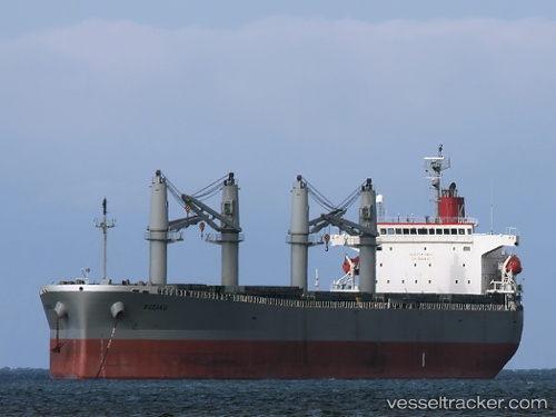
Vessel JETOUR IMO: 9317377, MMSI: 355557000 Bulk Carrier
UTC, -4.04673, 40.04139, course: 233, speed: 1.6
UTC, -3.98918, 40.05899, course: 257, speed: 1.3
2026-03-05 05:38:41 UTC, -3.96623, 40.07084, course: 293, speed: 1.6
Live Vessel JETOUR Analytics (details, animations, etc.)
Live AIS position: UTC. 24 nm E of Mombasa), updated 2026-03-05 05:38:41 UTC.Find the position of the vessel JETOUR on the map. The latter are known coordinates and path.
marine traffic ship tracker show on live map
The current position of vessel JETOUR is -3.96623 lat / 40.07084 lng. Updated: 2026-03-05 05:38:41 UTCCurrently sailing under the flag of Panama
JETOUR built in 2006 year
Deadweight:
54881 tDetails:
Last coordinates of the vessel:
UTC, -4.10789, 40.02101, course: 277, speed: 1.6UTC, -4.04673, 40.04139, course: 233, speed: 1.6
UTC, -3.98918, 40.05899, course: 257, speed: 1.3
2026-03-05 05:38:41 UTC, -3.96623, 40.07084, course: 293, speed: 1.6