 vesseltracker.com
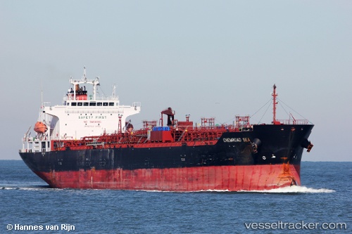
Vessel Chemroad Sea IMO: 9565730, MMSI: 357364000 Chemical Oil Products Tanker
UTC, -35.82797, -51.17350, course: 101, speed: 13.2
UTC, -35.82797, -51.17350, course: 101, speed: 13.2
2026-03-04 15:46:29 UTC, -35.82797, -51.17350, course: 101, speed: 13.2
Live Vessel Chemroad Sea Analytics (details, animations, etc.)
Live AIS position: UTC. 162 nm SE of LA PALOMA), updated 2026-03-04 15:46:29 UTC.Find the position of the vessel Chemroad Sea on the map. The latter are known coordinates and path.
marine traffic ship tracker show on live map
The current position of vessel Chemroad Sea is -35.82797 lat / -51.17350 lng. Updated: 2026-03-04 15:46:29 UTCCurrently sailing under the flag of Panama
Chemroad Sea built in 2011 year
Deadweight:
33560 tDetails:
Last coordinates of the vessel:
UTC, -35.76178, -51.53369, course: 101, speed: 12.9UTC, -35.82797, -51.17350, course: 101, speed: 13.2
UTC, -35.82797, -51.17350, course: 101, speed: 13.2
2026-03-04 15:46:29 UTC, -35.82797, -51.17350, course: 101, speed: 13.2