 vesseltracker.com
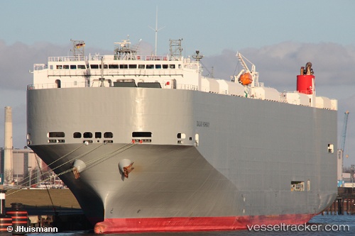
Vessel Dalian Highway IMO: 9565560, MMSI: 357694000 Vehicles Carrier
UTC, 18.00220, 108.45203, course: 155, speed: 16
UTC, 17.53457, 108.78736, course: -1, speed: 16.3
2026-03-04 17:44:21 UTC, 17.51431, 108.79798, course: -1, speed: 16.2
Live Vessel Dalian Highway Analytics (details, animations, etc.)
Live AIS position: UTC. 56 nm SW of San-Ya Chiang), updated 2026-03-04 17:44:21 UTC.Find the position of the vessel Dalian Highway on the map. The latter are known coordinates and path.
marine traffic ship tracker show on live map
The current position of vessel Dalian Highway is 17.51431 lat / 108.79798 lng. Updated: 2026-03-04 17:44:21 UTCDetails:
Last coordinates of the vessel:
UTC, 18.30633, 108.25436, course: 147, speed: 15.9UTC, 18.00220, 108.45203, course: 155, speed: 16
UTC, 17.53457, 108.78736, course: -1, speed: 16.3
2026-03-04 17:44:21 UTC, 17.51431, 108.79798, course: -1, speed: 16.2