 vesseltracker.com
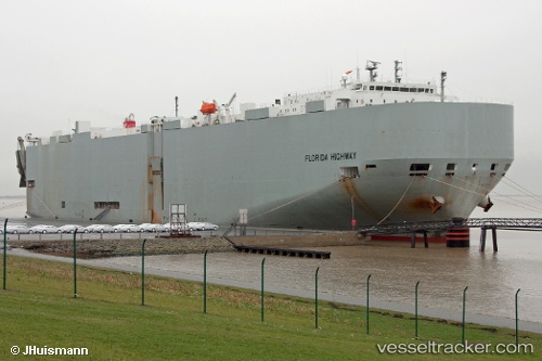
Vessel Florida Highway IMO: 9442861, MMSI: 372805000 Vehicles Carrier
UTC, 44.74755, -127.93523, course: 245, speed: 16.6
UTC, 43.77203, -130.38007, course: 222, speed: 2.1
2026-03-05 01:50:00 UTC, 43.59197, -130.84669, course: 245, speed: 14.9
Live Vessel Florida Highway Analytics (details, animations, etc.)
Live AIS position: UTC. 220 nm SE of Primorsky Krai), updated 2026-03-05 01:50:00 UTC.Find the position of the vessel Florida Highway on the map. The latter are known coordinates and path.
marine traffic ship tracker show on live map
The current position of vessel Florida Highway is 43.59197 lat / -130.84669 lng. Updated: 2026-03-05 01:50:00 UTCCurrently sailing under the flag of Panama
Florida Highway built in 2008 year
Deadweight:
18930 tDetails:
Last coordinates of the vessel:
UTC, 44.74755, -127.93523, course: 245, speed: 16.6UTC, 44.74755, -127.93523, course: 245, speed: 16.6
UTC, 43.77203, -130.38007, course: 222, speed: 2.1
2026-03-05 01:50:00 UTC, 43.59197, -130.84669, course: 245, speed: 14.9