 vesseltracker.com
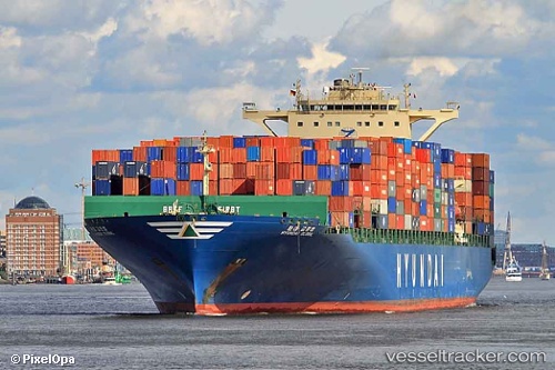
Vessel Hyundai Global IMO: 9393022, MMSI: 373021000 Container Ship
UTC, 43.66786, 150.41840, course: 64, speed: 12.8
UTC, 43.93594, 151.16980, course: 64, speed: 12.5
2026-03-05 04:14:15 UTC, 44.09078, 151.59976, course: 65, speed: 12.6
Live Vessel Hyundai Global Analytics (details, animations, etc.)
Live AIS position: UTC. 106 nm S of Trebnje), updated 2026-03-05 04:14:15 UTC.Find the position of the vessel Hyundai Global on the map. The latter are known coordinates and path.
marine traffic ship tracker show on live map
The current position of vessel Hyundai Global is 44.09078 lat / 151.59976 lng. Updated: 2026-03-05 04:14:15 UTCCurrently sailing under the flag of Panama
Hyundai Global built in 2009 year
Deadweight:
99086 tDetails:
Last coordinates of the vessel:
UTC, 43.47563, 149.90910, course: 71, speed: 13.1UTC, 43.66786, 150.41840, course: 64, speed: 12.8
UTC, 43.93594, 151.16980, course: 64, speed: 12.5
2026-03-05 04:14:15 UTC, 44.09078, 151.59976, course: 65, speed: 12.6