 vesseltracker.com
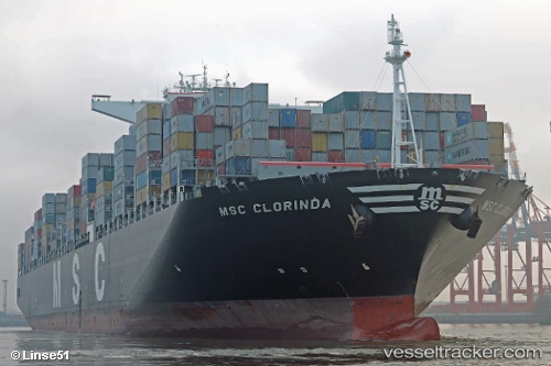
Vessel Msc Clorinda IMO: 9484429, MMSI: 373233000 Container Ship
UTC, -32.48262, 16.51524, course: 143, speed: 18.5
UTC, -32.64646, 16.65823, course: 144, speed: 18
2026-03-04 19:33:58 UTC, -33.20918, 17.16121, course: 143, speed: 18.7
Live Vessel Msc Clorinda Analytics (details, animations, etc.)
Live AIS position: UTC. 36 nm W of Saldanha Bay), updated 2026-03-04 19:33:58 UTC.Find the position of the vessel Msc Clorinda on the map. The latter are known coordinates and path.
marine traffic ship tracker show on live map
The current position of vessel Msc Clorinda is -33.20918 lat / 17.16121 lng. Updated: 2026-03-04 19:33:58 UTCDetails:
Last coordinates of the vessel:
UTC, -31.74649, 15.86358, course: 145, speed: 18.1UTC, -32.48262, 16.51524, course: 143, speed: 18.5
UTC, -32.64646, 16.65823, course: 144, speed: 18
2026-03-04 19:33:58 UTC, -33.20918, 17.16121, course: 143, speed: 18.7