 vesseltracker.com
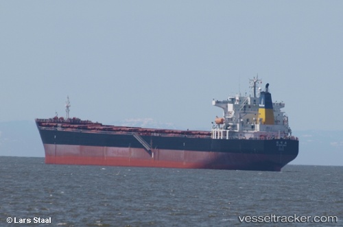
Vessel De Ming Hai IMO: 9364746, MMSI: 412068000 Bulk Carrier
UTC, 35.60446, 119.79365, course: 237, speed: 0.1
UTC, 35.60447, 119.79371, course: 237, speed: 0.1
2026-03-05 03:54:18 UTC, 35.60444, 119.79364, course: 237, speed: 0.1
Live Vessel De Ming Hai Analytics (details, animations, etc.)
Live AIS position: UTC. Near DONGJIAKOU), updated 2026-03-05 03:54:18 UTC.Find the position of the vessel De Ming Hai on the map. The latter are known coordinates and path.
marine traffic ship tracker show on live map
The current position of vessel De Ming Hai is 35.60444 lat / 119.79364 lng. Updated: 2026-03-05 03:54:18 UTCCurrently sailing under the flag of China
De Ming Hai built in 2008 year
Deadweight:
76432 tDetails:
Last coordinates of the vessel:
UTC, 35.60451, 119.79359, course: 237, speed: 0.1UTC, 35.60446, 119.79365, course: 237, speed: 0.1
UTC, 35.60447, 119.79371, course: 237, speed: 0.1
2026-03-05 03:54:18 UTC, 35.60444, 119.79364, course: 237, speed: 0.1