 vesseltracker.com
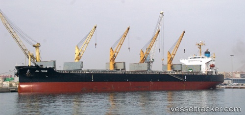
Vessel XIN AN NING IMO: 9407859, MMSI: 412345000 Bulk Carrier
UTC, 31.23700, 29.72685, course: 355, speed: 0.1
UTC, 31.23725, 29.72715, course: 334, speed: 0
2026-03-05 03:20:55 UTC, 31.23735, 29.72738, course: 330, speed: 0
Live Vessel XIN AN NING Analytics (details, animations, etc.)
Live AIS position: UTC. Near EL DEKHEILA), updated 2026-03-05 03:20:55 UTC.Find the position of the vessel XIN AN NING on the map. The latter are known coordinates and path.
marine traffic ship tracker show on live map
The current position of vessel XIN AN NING is 31.23735 lat / 29.72738 lng. Updated: 2026-03-05 03:20:55 UTCCurrently sailing under the flag of China Peopless Republic
XIN AN NING built in 2009 year
Deadweight:
55256 tDetails:
Last coordinates of the vessel:
UTC, 31.23711, 29.72732, course: 338, speed: 0.1UTC, 31.23700, 29.72685, course: 355, speed: 0.1
UTC, 31.23725, 29.72715, course: 334, speed: 0
2026-03-05 03:20:55 UTC, 31.23735, 29.72738, course: 330, speed: 0