 vesseltracker.com
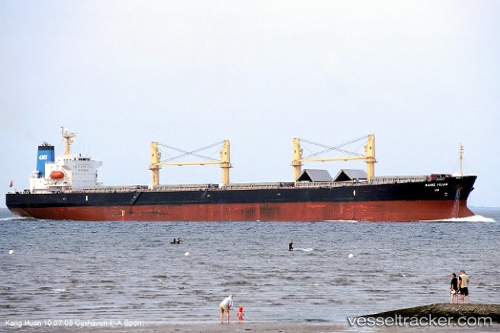
Vessel KANG HUAN IMO: 9277644, MMSI: 413219610 Bulk Carrier
UTC, 6.13717, 92.72045, course: 89, speed: 11
UTC, 6.14574, 93.06278, course: 87, speed: 12.2
2026-03-04 23:28:07 UTC, 6.14982, 93.37857, course: 83, speed: 10.4
Live Vessel KANG HUAN Analytics (details, animations, etc.)
Live AIS position: UTC. 116 nm W of Sebang), updated 2026-03-04 23:28:07 UTC.Find the position of the vessel KANG HUAN on the map. The latter are known coordinates and path.
marine traffic ship tracker show on live map
The current position of vessel KANG HUAN is 6.14982 lat / 93.37857 lng. Updated: 2026-03-04 23:28:07 UTCCurrently sailing under the flag of China Peopless Republic
KANG HUAN built in 2004 year
Deadweight:
52810 tDetails:
Last coordinates of the vessel:
UTC, 6.09289, 91.44906, course: 100, speed: 11.5UTC, 6.13717, 92.72045, course: 89, speed: 11
UTC, 6.14574, 93.06278, course: 87, speed: 12.2
2026-03-04 23:28:07 UTC, 6.14982, 93.37857, course: 83, speed: 10.4