 vesseltracker.com
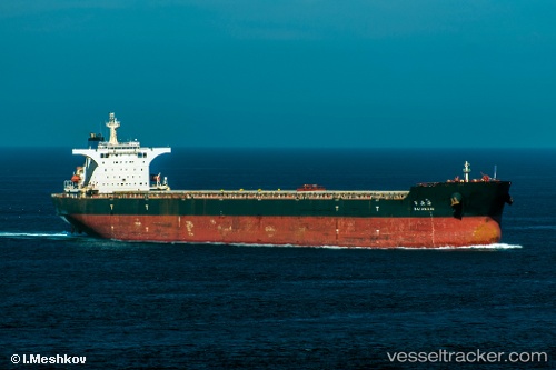
Vessel Bai An Hai IMO: 9395197, MMSI: 413424000 Bulk Carrier
UTC, 27.92563, 123.75830, course: -1, speed: 9.5
UTC, 28.33299, 123.80935, course: -1, speed: 10.5
2026-03-04 21:14:29 UTC, 28.51142, 123.79452, course: -1, speed: 10.7
Live Vessel Bai An Hai Analytics (details, animations, etc.)
Live AIS position: UTC. 96 nm E of Wenling Longmen Port), updated 2026-03-04 21:14:29 UTC.Find the position of the vessel Bai An Hai on the map. The latter are known coordinates and path.
marine traffic ship tracker show on live map
The current position of vessel Bai An Hai is 28.51142 lat / 123.79452 lng. Updated: 2026-03-04 21:14:29 UTCDetails:
Last coordinates of the vessel:
UTC, 27.62360, 123.68500, course: -1, speed: 9.5UTC, 27.92563, 123.75830, course: -1, speed: 9.5
UTC, 28.33299, 123.80935, course: -1, speed: 10.5
2026-03-04 21:14:29 UTC, 28.51142, 123.79452, course: -1, speed: 10.7