 vesseltracker.com
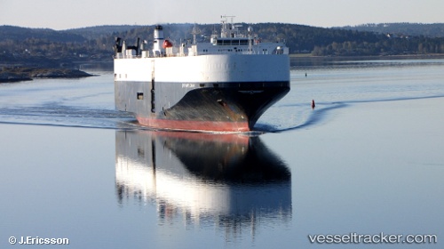
Vessel Chang Rong Kou IMO: 9177038, MMSI: 414276000 Vehicles Carrier
UTC, -15.81444, 65.90936, course: 57, speed: 15.8
UTC, -15.50500, 66.32167, course: -1, speed: 15
2026-03-04 18:11:47 UTC, -15.13679, 66.81816, course: -1, speed: 14.8
Live Vessel Chang Rong Kou Analytics (details, animations, etc.)
Live AIS position: UTC. 335 nm NE of Port Mathurin), updated 2026-03-04 18:11:47 UTC.Find the position of the vessel Chang Rong Kou on the map. The latter are known coordinates and path.
marine traffic ship tracker show on live map
The current position of vessel Chang Rong Kou is -15.13679 lat / 66.81816 lng. Updated: 2026-03-04 18:11:47 UTCCurrently sailing under the flag of China
Chang Rong Kou built in 2000 year
Deadweight:
12778 tDetails:
Last coordinates of the vessel:
UTC, -16.21167, 65.36833, course: -1, speed: 15UTC, -15.81444, 65.90936, course: 57, speed: 15.8
UTC, -15.50500, 66.32167, course: -1, speed: 15
2026-03-04 18:11:47 UTC, -15.13679, 66.81816, course: -1, speed: 14.8